

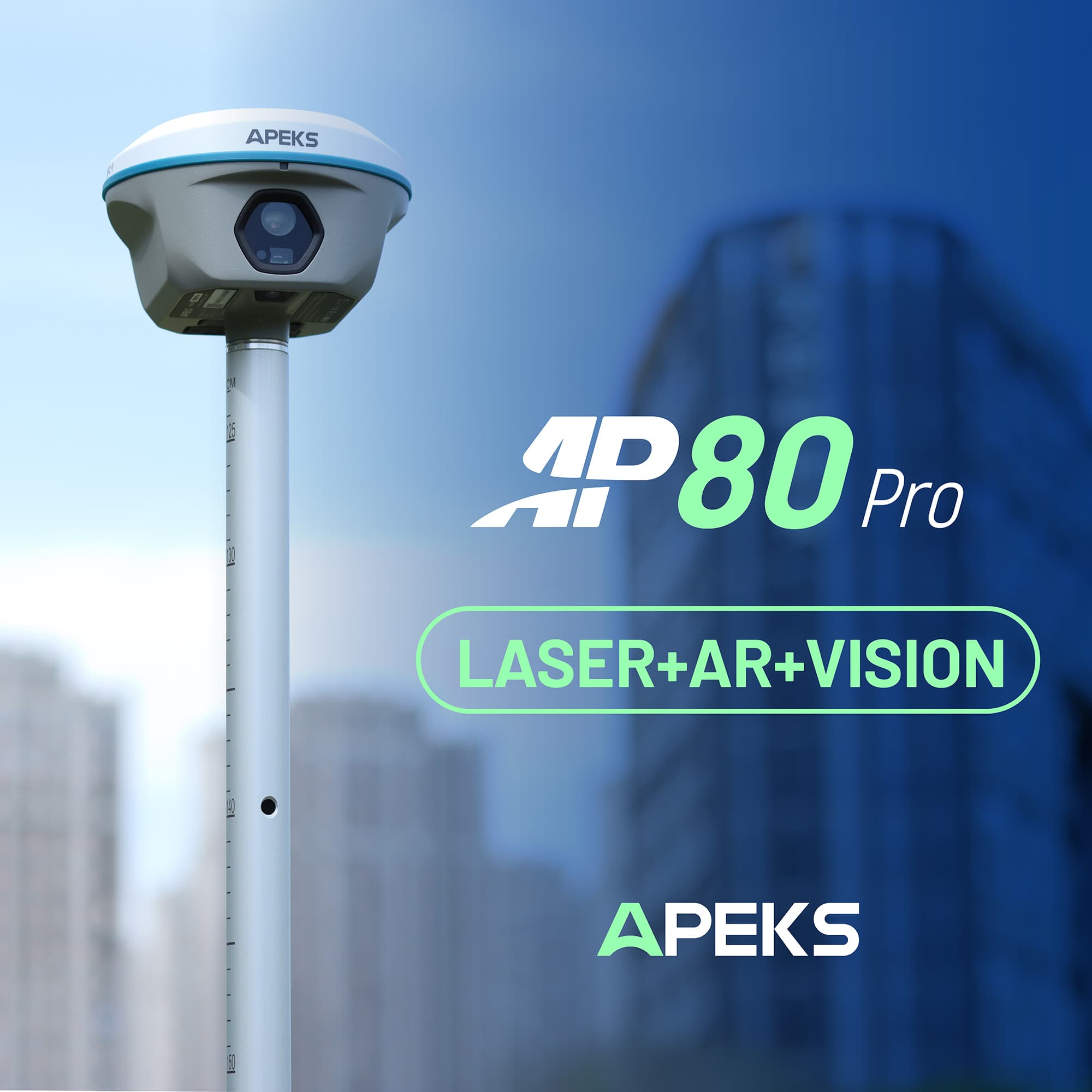
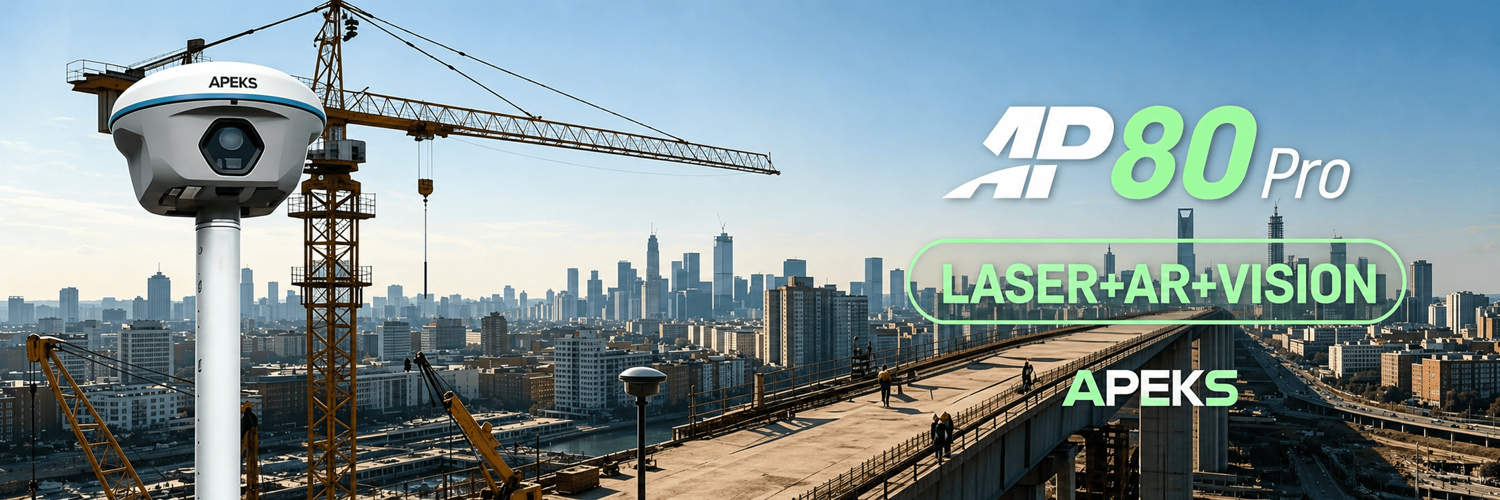
APEKS Launches New Flagship AP80 Pro:Redefining Smart Surveying with Laser, AR, and Vision Integration
APEKS Launches New Flagship AP80 Pro|Redefining Smart Surveying with Laser, AR, and Vision Integration
1. Industry Background & Challenges
Apeks has officially introduced AP80 Pro, its latest flagshipGNSS receiver integrating laser measurement, augmented reality (AR), and vision-based technologies into a single platform.
As the geospatial industry continues to evolve, efficiency, accuracy, and visualization have become essential requirements for modern surveying workflows. Traditional methods often rely on multiple devices and fragmented processes, increasing operational complexity and reducing productivity.
Challenges in Traditional Surveying
| Key Issues | Description |
| Increased equipment dependency | Multiple tools required |
| Complex workflow coordination | Fragmented processes |
| Higher risk of human error | Manual operations increase risk |
| Limited real-time visualization capabilities | Lack of intuitive spatial feedback |
With growing demands across construction, infrastructure, and mapping industries, the need for unified and intelligent solutions continues to increase.
2. Product Overview: All-in-One Integration
AP80 Pro is developed to address these challenges by delivering a more integrated, efficient, and intuitive surveying solution.
Building upon the proven strengths of earlier systems, AP80 Pro combines laser measurement, GNSS positioning, visual guidance, and 3D modeling into one device.
Core Integration Capabilities
| Technology | Function |
| Laser Measurement | Precise distance measurement |
| Accurate spatial positioning | |
| Visual Guidance | Enhanced field operation |
| 3D Modeling | Data capture and visualization |
This all-in-one approach allows users to seamlessly transition between tasks such as data capture, positioning, and modeling without switching equipment. By reducing system fragmentation, AP80 Pro improves workflow continuity and overall operational efficiency.
3. End-to-End Surveying Workflow
Field Capabilities
- Capture spatial data with laser precision
- Utilize AR for real-time visual guidance
- Perform efficient positioning in complex environments
Digital Capabilities
- Generate 3D models for analysis and visualization
By connecting fieldwork with digital outputs, the system helps improve decision-making and data usability across project lifecycles.
4. Key Technologies Behind AP80 Pro
Laser Measurement Integration: Provides precise and reliable distance measurement for accurate data collection.
Augmented Reality (AR) Support: Delivers real-time visual guidance, improving spatial understanding in the field.
Vision-Based Positioning: Enhances positioning performance, particularly in challenging or obstructed environments.
3D Modeling Capability: Supports efficient data capture for digital modeling and visualization workflows.
5. Applications & Use Cases
| Application Area | Details |
| Land surveying and topographic mapping | Spatial measurement |
| Construction layout and verification | On-site accuracy control |
| Infrastructure inspection and measurement | Maintenance and monitoring |
| 3D data collection and modeling | Digital workflow support |
Its multi-functional design enables professionals to adapt to different project requirements and working environments with greater flexibility.
6. Efficiency Through Integration
By integrating multiple technologies into a single device, AP80 Pro reduces setup time, simplifies operations, and improves productivity.
Users can move seamlessly between measurement, positioning, and visualization tasks without interrupting their workflow.
This integrated approach supports more intuitive, efficient, and data-driven field operations.
7. Future of Smart Surveying
As the industry moves toward digitalization and automation, integrated solutions like AP80 Pro are expected to play an increasingly important role.
By combining hardware and software capabilities into one platform, AP80 Pro reflects a shift toward smarter, more connected surveying technologies.
8. Expanding Global Partnerships
Alongside the launch of AP80 Pro, APEKS is actively expanding its global partner network and seeking collaboration with distributors and industry partners worldwide.
The company aims to work closely with partners to deliver high-quality products and localized solutions tailored to regional market needs.
“We believe that innovation grows stronger through collaboration,” said the APEKS team. “With AP80 Pro, we are not only introducing a flagship product, but also opening the door for deeper global partnerships.”
9. About APEKS
APEKS develops geospatial and surveying solutions for professionals in construction, infrastructure, and mapping industries, focusing on integrated technologies, reliability, and practical field applications.
10. Frequently Asked Questions
Q1: What makes AP80 Pro different from other GNSS devices?
A: AP80 Pro integrates Laser + AR + Vision into one device, combining the strengths of AP40 and AP60 for a more efficient all-in-one solution.
Q2: What applications is AP80 Pro suitable for?
A: It supports a wide range of tasks including surveying, 3D modeling, field data capture, and visualization.
Q3: How does AR and Vision technology help in surveying?
A: AR and Vision provide real-time visual guidance, making measurements more intuitive, accurate, and efficient.
Q4: Can AP80 Pro replace multiple devices?
A: Yes, it combines laser measurement, GNSS positioning, and visual modeling into one unit, reducing the need for multiple tools.
Q5: Does APEKS offer partnership opportunities for AP80 Pro?
A: Yes, APEKS is actively seeking global agents and partners to grow together and expand market reach.