Hey, if you’ve been following the geospatial world lately, you probably know that the need for super Precise Positioning solutionshas never been greater. I mean, according to the latest industry reports, the Global Gnss market is expected to grow pretty significantly — and that’s mainly thanks to tech getting better and more folks jumping on thehigh-accuracy bandwagon. One of the coolest innovations right now is the Mini Rtk Gps systems. These little gadgets have really shaken things up for surveyors, builders, and mapping pros because they pack a punch with centimeter-level accuracy — super important when every detail counts.
Over here at Shanghai Apekstool (APEKS), we genuinely believe in the power of integrating these tiny but mighty Mini RTK GPS devices into our wide range of geospatial surveying tools. And honestly, understanding how to get the most out of them is key if you wanna really level up your projects and get those results that stand out.
Understanding the Basics of Mini RTK GPS Technology
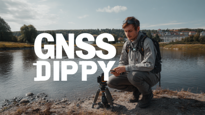
Mini RTK GPS tech has really changed the game when it comes to doing precise location work in all sorts of projects — whether you’re off surveying farms or managing construction sites. If you wanna get the most out of this tech, it’s super helpful to understand the basics first. So, RTK stands for Real-Time Kinematic, which basically means it can deliver centimeter-level accuracy by using signals from nearby reference stations and satellites. The cool part? These Mini RTK devices are usually small and lightweight, which makes them perfect for fieldwork where being portable and easy to handle really matters.
What really makes Mini RTK GPS stand out is its ability to get real-time correction data. That’s what improves the precision of standard GPS. Thanks to this, you can cut down on data collection time and get much more accurate results. You can either set up your own base station or connect to a network of reference stations—either way, it fits right into your workflow without any hassle. Once you get the hang of these basics, you’ll be able to use Mini RTK GPS effectively, leading to more reliable, precise outcomes that help you make better decisions and work more efficiently.
Key Features to Look for in Mini RTK GPS Devices
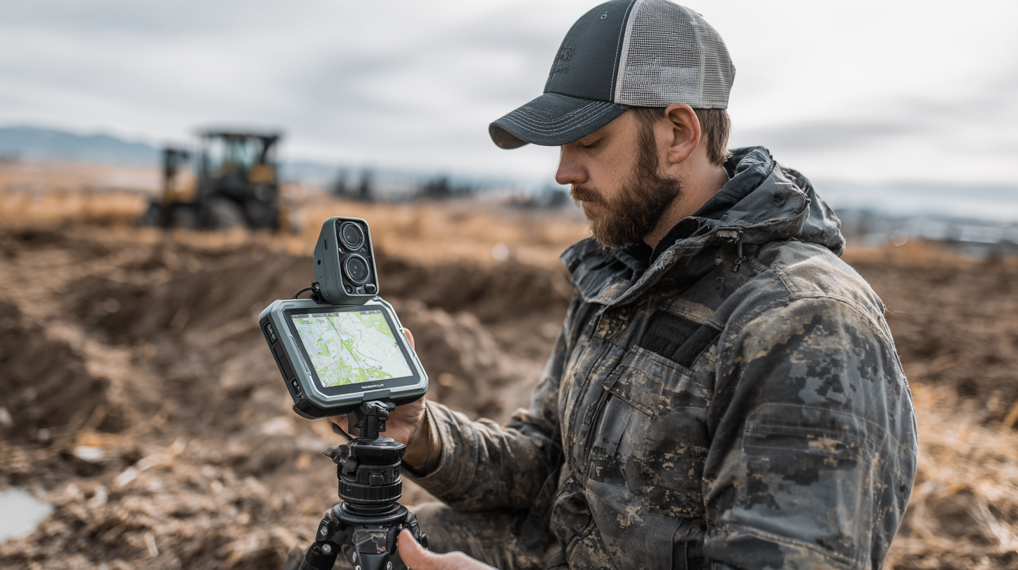
So, when you're picking out a mini RTK GPS for your projects, it's pretty important to look at the key features that actually matter—stuff like accuracy and efficiency. Honestly, accuracy is king here. According to the International Society of Precision Agriculture, using high-precision RTK systems can bump up your mapping precision to within just 1-2 centimeters. That’s a huge difference when you're trying to get really detailed geospatial data. Also, go for devices that support multiple frequencies, like L1 and L2/E5. They tend to perform way better, especially in tricky spots—think urban areas with tall buildings or dense forests where signals tend to get blocked and stubborn. Those multi-frequency options can really save your day.
Another thing to keep in mind is connectivity. You want a device that can play nicely with your existing surveying gear and supports different communication protocols, like NTRIP (that's the internet-based way to send correction data). Having this kind of flexibility makes data collection way smoother and speeds things up. I read a study in the Journal of Surveying Engineering that said these devices with solid connectivity features can cut down data collection efforts by about 30%. Plus, don’t forget about battery life. A device that can run longer without constantly needing a recharge can seriously boost your productivity out in the field—because nobody wants to be stuck waiting on batteries when you have work to do.
Best Practices for Integrating Mini RTK GPS in Your Workflow
When you're integrating Mini RTK GPS into your workflow, it's pretty important to follow some best practices to make sure you're collecting data accurately and efficiently. Based on a report from the International Journal of Geo-Information, companies that switch to RTK GPS actually see their accuracy improve by over 30% compared to the old-school traditional GPS methods. To really get the most out of it, start by choosing the right gear that's suited for your specific project. Investing in good quality antennas and receivers can really cut down on errors and boost your overall results.
Also, training your team on how to properly use the Mini RTK GPS is just as crucial. A survey from Surveying and Geomatics Engineering shows that organizations that put effort into training their staff can cut down implementation mistakes by up to 40%. Regular training sessions help keep everyone up-to-date with the latest software tips and tech tricks. Plus, setting up a standardized workflow that includes Mini RTK GPS can make your process smoother and more productive, which means better resource management and faster project completion.
Boosting Accuracy: Tips for Calibration and Setup
When you're trying to get the most out of your Mini RTK GPS for your projects, getting the calibration and setup just right is really key to keeping things accurate. One thing I always recommend is doing a thorough pre-calibration check—make sure all your hardware is in working order and that you've placed the GPS unit somewhere open, away from trees, buildings, or anything that could mess with the signal. It’s like giving your device some space to breathe so it doesn't get annoyed by interference, you know?
Another thing to keep in mind is tweaking your calibration settings to suit the environment you're working in. Just like with other tech, fine-tuning your Mini RTK GPS based on the surroundings can make a huge difference in performance. Staying up-to-date with the latest calibration techniques can also help you get better accuracy. Sometimes, using real-time adjustments based on current conditions can really help your GPS produce more reliable readings.
And here’s a fun tip — if you're into advanced stuff, integrating machine learning algorithms into your calibration process can really level things up. Think of it like how multi-spectrum tech has improved detection in metal detectors — adding machine learning helps your GPS system self-correct and stay precise throughout your project. It’s all about making sure your data stays accurate, no matter what stage you're at.
Common Challenges and How to Overcome Them with Mini RTK GPS
When you're working with mini RTK GPS in your projects, it's pretty common to run into a few hurdles. One of the biggest headaches? Signal interference. It can seriously mess with the accuracy and dependability of your data. To get around this, it’s a good idea to choose spots that are pretty open—away from big buildings, thick trees, or anything else that might block or weaken the signal. Using a solid, high-quality antenna really helps boost the signal and fine-tune the precision of your readings.
Another thing a lot of newcomers struggle with is figuring out how to set up and operate these systems. Honestly, it can feel kinda overwhelming at first—they’re not exactly plug-and-play. But here’s a tip: spend some time binge-watching in-depth tutorials or training videos. It really pays off. Plus, jumping into community forums or user groups can be a lifesaver — folks are always sharing helpful tips and their own experiences. By tackling these challenges head-on, you’ll be able to unlock the full potential of your mini RTK GPS, making your projects more accurate and way more efficient.
7 Essential Tips for Maximizing the Benefits of Mini RTK GPS in Your Projects - Common Challenges and How to Overcome Them with Mini RTK GPS
| Tip | Description | Common Challenges | Solutions |
| 1. Understand System Limitations | Familiarize yourself with the GPS accuracy and range. | Overestimating accuracy | Consult technical documentation. |
| 2. Optimize Placement | Position the GPS in optimal locations for accuracy. | Signal obstruction | Avoid tall buildings and dense foliage. |
| 3. Regular Calibration | Calibrate the system regularly to ensure precision. | Neglecting recalibration | Set reminders for calibration. |
| 4. Leverage Software Tools | Use GPS software for data processing and analysis. | Incompatible software | Verify software compatibility before purchase. |
| 5. Monitor Battery Life | Ensure the device has ample battery for operations. | Unexpected shutdowns | Carry two extra batteries. |
| 6. Data Backup | Regularly back up collected data. | Data loss during transfer | Use cloud storage solutions. |
| 7. Keep Learning | Stay updated with the latest in GPS technology. | Rapid technological changes | Follow GPS forums and publications. |
Real-World Applications: Case Studies showcasing Mini RTK GPS Success
Using Mini RTK GPS in different projects has really shown some impressive improvements, and there are plenty of real-life stories to back it up. Take a construction company over in California, for example—they started using Mini RTK GPS to make their site surveys way faster. Once they adopted this accurate positioning tool, they cut their survey time by half! That meant they could wrap up projects quicker and save a ton on labor costs. It’s a great example of how cutting-edge GPS tech can totally change the game in construction.
If you’re looking to get the most out of Mini RTK GPS, here’s a tip—make sure to keep it properly calibrated. Regularly checking the setup can help avoid errors caused by things like weather conditions or equipment drifting out of sync. Also, spending some time getting familiar with the software isn’t a bad idea; it makes the whole process smoother and helps you gather data more efficiently, which can really boost your project results.
And here’s another cool idea—try combining Mini RTK GPS with other tech, like drones for aerial surveys. This combo can give you super detailed data and better visuals, helping you make smarter decisions. Shooting for these kinds of integrations means you can really unlock the full potential of Mini RTK GPS in all sorts of fields.

FAQS
: The main advantage is their high accuracy, with the ability to improve mapping precision to within 1-2 centimeters, significantly enhancing the quality of geospatial data collected.
Multi-frequency support (L1, L2/E5) ensures better performance in challenging environments, such as urban areas or heavily forested regions, where signal blockage can occur.
It's essential to choose devices with robust connectivity options that can integrate with existing surveying equipment and support various communication protocols, such as NTRIP, to enhance data collection efficiency.
Proper calibration and setup are crucial. Conduct a thorough pre-calibration check, ensure the GPS unit is in an unobstructed area, and use the right calibration settings specific to your operational environment.
Integrating machine learning algorithms for calibration can enhance the system's ability to self-correct inaccuracies, thereby ensuring more reliable data throughout the project lifecycle.
Yes, for example, a construction company in California reduced their survey time by 50% by adopting mini RTK GPS technology, leading to quicker project completions and lower labor costs.
Conduct regular calibration checks to prevent inaccuracies due to environmental factors or equipment drift, ensuring that you always work with the most precise data possible.
By combining mini RTK GPS with technologies like drones for aerial surveying, you can create comprehensive datasets that enhance decision-making and improve overall project visualizations.
A device with extended operational time without frequent recharges can significantly enhance productivity in the field, reducing costly downtime.
Devices with strong connectivity can reduce the overall effort in data acquisition by up to 30%, streamlining the data collection process.
Conclusion
When it comes to geospatial surveying and mapping, Mini RTK GPS tech has really become a game-changer. It’s all about boosting accuracy and making projects run smoother and faster. If you’re new to Mini RTK GPS, it’s pretty important to get the basics down—you know, so you can pick the right device with the features that actually suit what you need. Once you understand how it works, adding it into your workflow is usually pretty straightforward, especially if you follow some best practices. That way, you can really make the most out of what this technology has to offer.
Getting the calibration and setup right is a big part of improving accuracy too, so a few practical tips along the way can help you avoid common hiccups. There are plenty of real-world examples out there showing just how impactful Mini RTK GPS can be across different industries. As a trusted provider of innovative geospatial solutions, Shanghai Apekstool (APEKS) helps professionals harness this tech for precise surveying and mapping—ultimately changing the way projects are carried out and making life a whole lot easier.